Are you tired of the heat like I am? Well, I got some good news, and some bad news. Long range data is indicating a possible cool down ahead. The bad news is that it is over a week away, and still only a possibility at the moment.
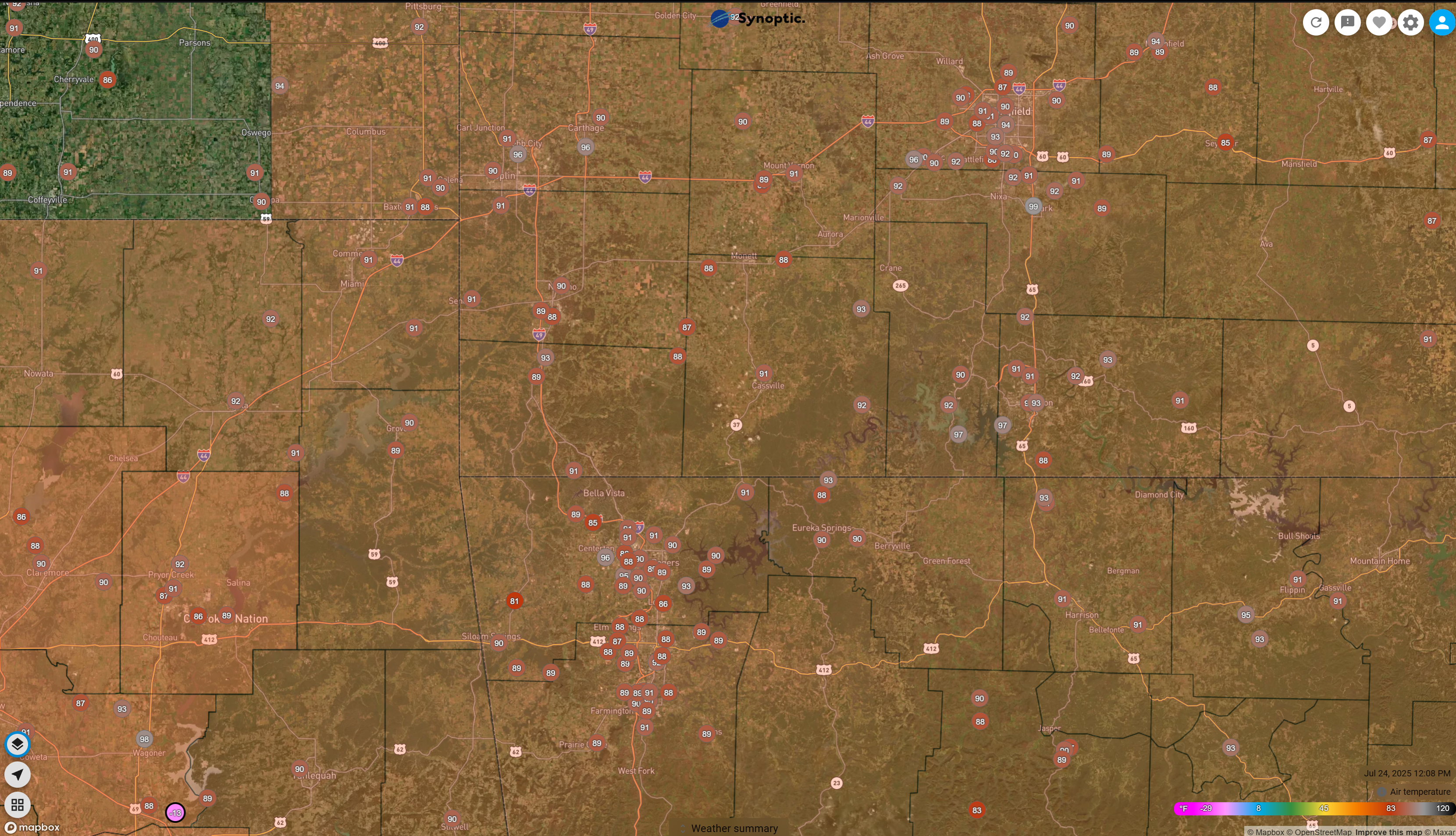
Current Conditions as of Noon on Thursday 7/24 as a heat advisory is in place across much of the coverage area, courtesy of our friends at Synoptic Weather.
So What are We Looking At?
The GFS Model is continuing to show hot conditions over Southwest Missouri, Northwest Arkansas, and Northeast Oklahoma through the weekend and majority of next week as well, so in the short term, the heat is not going anywhere!
While the cooldown won't been much, it will be a couple of days into the lower to mid 80's, which is cooler than it has been the last couple of weeks.
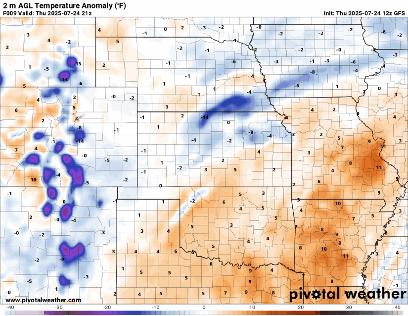
Below shows today through 7/31 on the temperature anomaly from our normal temperatures this time of year.
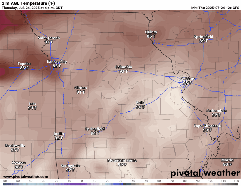
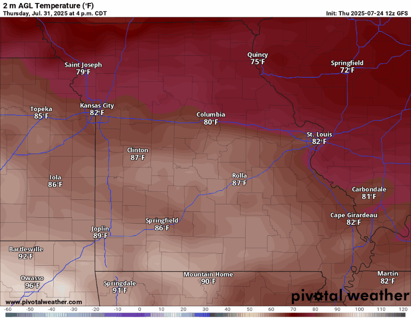
And here are the temperatures focused on Missouri during that time.
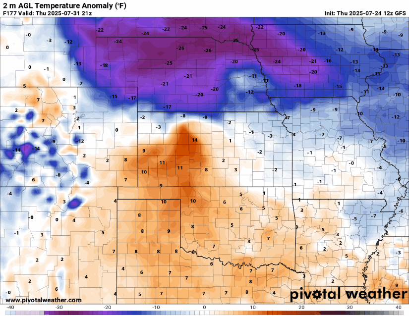
Here are also the look at next weekend (Aug 1st - Aug 3rd) in anomaly and temperatures.
Want to Support WoolawayWx?
Visit WoolawayWx.com/Support to see the ways you can support WoolawayWx! Sharing and interacting with post on Social Media also go a long way to help support as well!