Observations
During Friday and Saturday had decent drying conditions, however, those periods were wiped out by light rainfall Sunday morning with mean amounts being in the 0.1 to 0.2 inch range across the area.
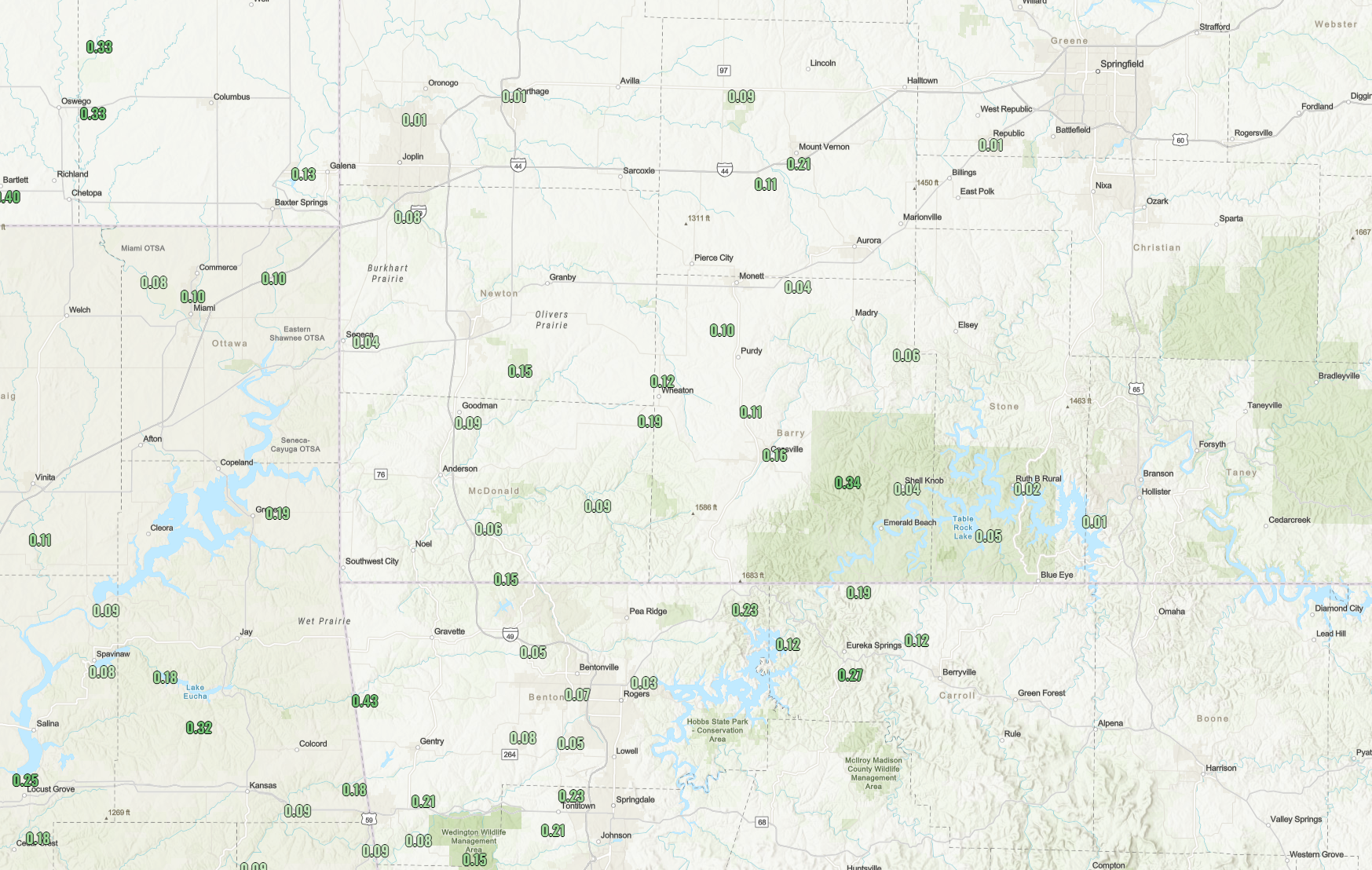
This light rainfall increased the moisture in the air as relative humidity values Sunday morning are in the 75-85% range across the area. It also added more moisture to windrows, and likely will be hard to get to dry to optimal moisture levels by Monday afternoon, however, it is possible especially those operations that can utilize a few rounds of tedding to try to get the entire windrow to dry out evenly.
Upcoming Week
Sunday - Tuesday Morning:
Decent conditions will persist across the remainder of Sunday and Monday, and into Tuesday Morning. This will provide a small window for those with hay down already to try to get it to dry out before Tuesday afternoon.
WoolawayWx's Recommendation: Do not cut any more hay.
Tuesday Afternoon - Friday:
Stormy and rainy conditions look to resume across the area starting Tuesday afternoon. Multiple rounds of rainfall look to bring 2-4" of additional rainfall to the area. As the ground saturation is >90% at the moment, most of this will result in runoff, and will create high moisture forage, with little to none drying potential. This will also create very wet field conditions that will present a risk for rutting and getting stuck.
WoolawayWx's Recommendation: Do not cut any hay.
Legal Disclaimer:
This information is provided for general planning and informational purposes only and should not be interpreted as agricultural, meteorological, or legal advice. Weather conditions can change rapidly and vary significantly by location. WoolawayWx is not responsible for any decisions or actions taken based on this information. Always consult local forecasts, agronomy experts, and consider your own operational capabilities when making forage management decisions.